Hurricane Ian recovery response bolstered by UAH satellite remote sensing data
Published 10:30 am Friday, October 7, 2022

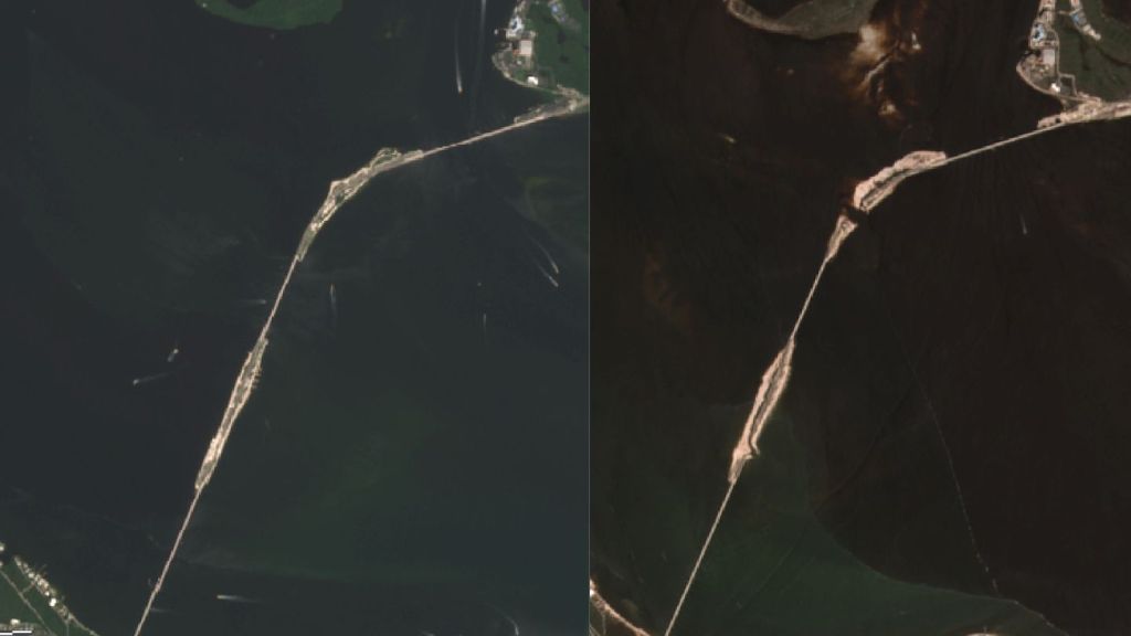
- At left, the true color imagery of Copernicus Sentinel-2 processed by Lucey and Sharp shows the Sanibel Causeway connecting Fort Myers, Fla., to Sanibel Island on Sept. 28 before Hurricane Ian made landfall. At right is the Sanibel Causeway on Sept. 30 at 11 a.m. Eastern time after Hurricane Ian. Part of the causeway was destroyed.
The recovery response to Hurricane Ian in Florida has been informed by the efforts of two University of Alabama in Huntsville (UAH) Earth System Science Center (ESSC) research associates who have been analyzing pre-event and post-event satellite remote sensing data.
Working from Cramer Hall at UAH, a part of the University of Alabama System, Ronan Lucey and Kaylee Sharp have been processing satellite data from NASA’s Landsat 8 & 9 and the European Space Agency’s Copernicus Sentinel-2 to create distinct composites that are being used for response efforts.
The composites are continuously evaluated by the Federal Emergency Management Agency (FEMA). The data provides situational awareness of flooding and storm damage across the State of Florida to assist FEMA and its partners.
One composite, the Shortwave Infrared Imagery of Copernicus Sentinel-2 , makes use of the reflective properties of water by enhancing them to highlight potentially flooded areas. Another composite, True Color Imagery of Copernicus Sentinel-2, brightens the color of geographic features so individuals and agencies can better detect storm damage.
Through a cooperative agreement with NASA’s Earth Science Applied Sciences Disasters program, UAH research associates process remote sensing data for numerous types of hydrometeorological events.
“We are involved with pretty much every response that has to do with hurricanes or storms,” says Lucey, who is UAH’s lead research associate for NASA’s Disasters program.
Lucey says that the composites developed by he and Sharp are highly regarded by FEMA, as NASA is one of the few agencies that provide free, openly available products to FEMA.
“If there are gaps FEMA can’t afford, or gaps in the flight lines from the private sector, that’s a place often where NASA products can fill in,” Lucey says.


