Corps works to restore Cumberland River Basin flood storage, reduce risk
Published 10:41 am Monday, February 17, 2025
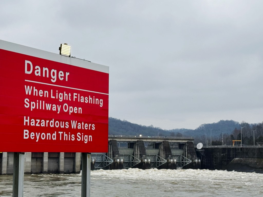
- A light flashes above a danger sign notifying boaters and other visitors of hazardous water conditions due to the release of water throught the Cordell Hull Dam in Carthage, Tennessee, on Feb. 16, 2025. USACE photo by Michael Davis
NASHVILLE, Tenn. – The U.S. Army Corps of Engineers Nashville District is implementing a phased approach to restore reservoir storage capacity in the Cumberland River Basin while maintaining flood risk management.
To ensure a balanced and effective water release strategy, the Corps’ Water Management team will continuously monitor river levels and dam operations using advanced hydrologic models and forecasting tools. This data-driven approach helps determine the optimal timing and locations for water releases, minimizing potential downstream impacts.
“Recent extreme rainfall and runoff in the Cumberland River Basin have reinforced the importance of our ongoing efforts to manage water levels effectively,” said Lt. Col. Robert Green, U.S. Army Corps of Engineers Nashville District commander. “Our team remains committed to restoring flood storage capacity while prioritizing public safety. We urge residents and visitors to stay aware of changing water conditions, especially near dams and other critical infrastructure.”
To manage flood risks and balance water levels, the Corps has made several operational/forecasted adjustments:
— Barkley Dam – Has increased spillway releases to 190,000 cubic feet per second in coordination with TVA & USACE.
— Old Hickory Dam – reduced spillway releases to 80,000 CFS.
— Cordell Hull Dam – increased spillway releases to 61,000 CFS.
— Cheatham Lock & Dam – project is currently in free flow (as is designed) releasing 118,000 CFS; navigation closed temporarily.
— Center Hill & Dale Hollow.
— Wolf Creek – began water releases through hydropower generation (2 units) today.
— J. Percy Priest Dams – currently not releasing, scheduled to resume later this week.
The flood control reservoirs that provide flood reduction benefits above Nashville are Martins Fork, Wolf Creek, Dale Hollow, Center Hill and J. Percy Priest. More than 500 billion gallons of water was stored in those reservoirs in the last week. Without the Corps ability to shut off releases from those dams, flood damages along the entire reach of the Cumberland River could have been more severe.
“With the mostly dry forecast for the upcoming week, it is important that we begin evacuating this stored water as soon as downstream conditions allow to reposition the reservoir system for future rainfall events,” said David Bogema, Nashville District Water Management section chief. “We are carefully monitoring the river stages in communities below our storage dams so that when we begin emptying our flood storage, we don’t cause more flooding. The safety of the public and their property is our top priority when managing our reservoirs.”
What is CFS and why does it matter?
CFS measures the volume of water flowing per second. One CFS = 7.5 gallons per second. 100,000 CFS can fill an Olympic-sized swimming pool in just 3 seconds.
Large dam releases help manage flood risks downstream but also create dangerous water conditions near the dams.
Current and estimated flood conditions
Cumberland River at Nashville: Stage crested early Sunday morning at 35.85 ft and is expected to slowly recede over the next week. While below minor flood stage (40 feet), portions of Riverfront Park is flooded, and access points from Nissan Stadium are inaccessible. Low-lying areas near the I-24 and I-65 bridges will see waters diminish over the next day.
Red River at Port Royal: Cresting now at 45.49 feet, which will be the third-highest flood crest on record since 1937 (compared to 49.5 ft in 2010 and 48.3 ft in 1975). Homes on Rivermont Dr, River Run, Idlewood Dr, and Wimbledon Ct may see floodwaters, and multiple roads could become impassable.
More details: NOAA Port Royal Gauge
Cumberland River at Clarksville: Expected to crest at 51.6 feet early Monday morning. Flooding will impact most agricultural and many commercial properties along the river, Riverfront Park, and roads including South Riverside Dr, North Riverside Dr, Quarry Rd, Kraft St, and Zinc Plant Rd.
More details: NOAA Clarksville Gauge
Cumberland River at Dover: Expected to crest just above minor flood stage at 67.6 feet by early Tuesday. Roads near the river will become impassable, and nearby farmland will flood.
Other areas of concern
Upper Cumberland (Williamsburg, Barbourville, Pineville, and Baxter) – Flood waves are beginning to crest. Harpeth River near Kingston Springs – Flood has crested in minor flood stage and is receding.
Martins Fork Lake: The lake elevation is currently at 1,331.8 feet, surpassing the previous all-time record of 1,331.6 feet set in April 1998. Martins Fork is expected to crest slightly above 1,332.0 feet overnight. All Nashville District Lake elevation and flow levels can be found at https://www.lrn-wc.usace.army.mil/project84.shtml
Public Safety reminders
— Stay away from dam release areas. High flows create strong currents, sudden surges, and life-threatening conditions for boaters, anglers, and swimmers.
— Avoid tailwaters and floodgates where water is actively being released.
— Respect all warning signs and restricted areas near dams.
— Do not attempt to navigate through high-flow areas—these waters are extremely turbulent.
The U.S. Army Corps of Engineers Nashville District manages the Cumberland River and its tributaries, balancing the demands for water releases to flood risk management, commercial navigation, production of hydropower, recreation, fish and wildlife, water supply and water quality.
The public can obtain news, updates and information from the U.S. Army Corps of Engineers Nashville District on the district’s website at https://www.lrd.usace.army.mil/About/Districts/Nashville-District/.