NWS confirms Monday damage from tornadoes
Published 7:00 pm Friday, December 20, 2019
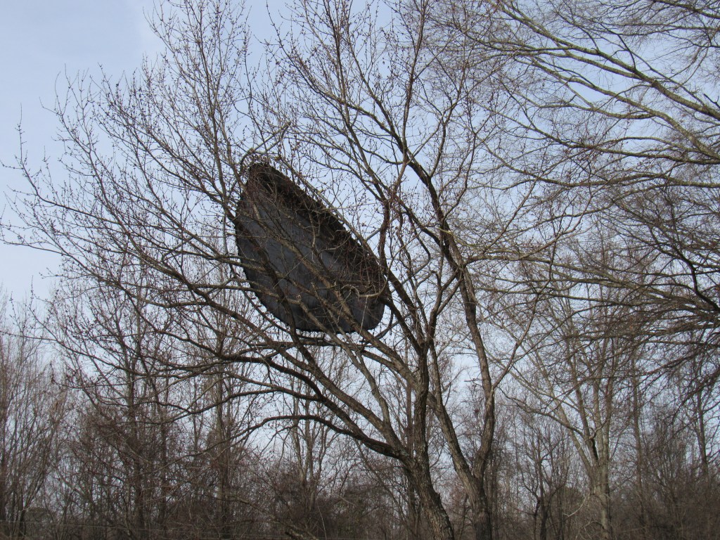
- A trampoline remains in a tree Friday morning. While the house below the tree was mostly spared by Monday's tornadoes, nearby homes were not so lucky.
The National Weather Service announced Thursday that Monday’s storm damage in Tanner and at Joe Wheeler State Park were the result of two tornadoes.
Each was an EF-1 with an estimated peak wind of about 110 mph. The first tornado formed around 5:20 p.m. Monday near the border of Joe Wheeler State Park, according to the NWS survey, and lasted about 4 minutes. Unfortunately, that’s all the time needed to leave a path of destruction nearly 3 miles long and up to 500 yards wide.
Trending
That path included thousands of uprooted or snapped trees throughout the park’s campground and day use area. The survey noted multiple structures were damaged as a result of the falling trees. The damage led to Joe Wheeler officials closing most of the park until power and phone lines were restored, and closing the campground and day use area until further notice.
Haley Newton, marketing manager for the park, told The News Courier on Wednesday officials felt very lucky that it was a slow season for the campground and rangers were able to evacuate everyone before the tornado formed.
Tanner twister
About 10 minutes after the Joe Wheeler tornado formed, a second tornado began its path in Tanner. NWS surveyors believe the twister started just east of the Browns Ferry Nuclear Plant and skipped along for about 9.5 miles.
The survey showed the tornado moved northeast from the plant until it was north of Tanner. In the 13 minutes between forming and disappearing, the tornado caused the most damage when it touched down east of the plant, according to the survey. A house near Neely Hill Loop had its roof mostly removed in the storm.
A warm Christmas
Trending
Dreams of a white Christmas will remain a dream this year, as meteorologists predict a warmer than usual holiday this year. In an area forecast discussion released Friday, the NWS Huntsville office called for rain over the weekend and perhaps even Monday, followed by “a period of warm and dry weather just in time of Christmas holiday.”
Tuesday and Wednesday could have some clouds, but highs are expected in the mid-60s.
“In other words, there’s no chance of a white Christmas this year,” the discussion said.